Fayl:BlankMap-World-1985.png
Basqa tillerde kórsetiw funkciyası bul bet ushın islemeydi.
Wikipedia, erkin enciklopediya

Túp fayl(1500 × 740 piksel, fayldıń ólshemi: 90 КБ, MIME tipi: image/png)

Bul fayl Wikimedia Commons den alınǵan hám basqa joybarlar tárepinen isletiliwi múmkin. Onıń fayl xarakteristikası beti xarakteristikası tómende kórsetilgen.

Juwmaq

Sıpatlama

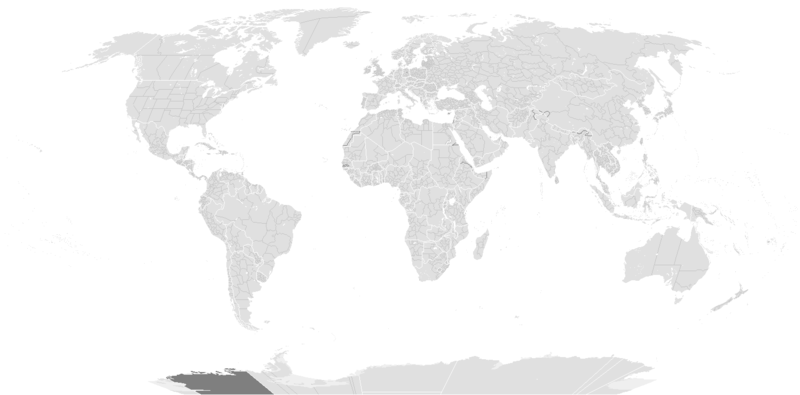
Blank political map of the world c.1985.

This is also officially accurate for the period between 1977 (South Africa imposes direct rule on Walvis Bay) - May 22 1990 (Unification of North and South Yemen). Unofficial border changes occurred between 1977 and 1990 which include in 1979 the US de facto hand over of the Panama Canal Zone to Panama (made official in December 1999) and in December 26, 1981 when the Iraq-Saudi Arabia Neutral Zone was partitioned between Iraq and Saudi Arabia but was only officially accepted in 1991.

Blank maps of the world for historical use
pre-1800

1 · 820 · 1500 · 1710


19th century

1840 · 1861 · 1866 · 1872 · 1898


20th century

1902 · 1912 · 1914 · WWI · Aug 1918 · 1920 · 1921 · 1924 · 1926 · 1935 · 1937 · Mar 1938 · Oct 1938 · Mar 1939 · Oct 1939 · WWII · Nov 1942 · May 1945 · 1957 · 1959 · 1962 · 1968 · 1970 · 1985 · 1990 · 1993


21st century

2000 · 2005 · 2007 · 2009 · Current

(this template: · view · discuss )
Sáne originally created before 13 May 2005
date QS:P,+2005-05-13T00:00:00Z/7,P1326,+2005-05-13T00:00:00Z/11
Fayl deregi from wikipedia
Avtor several/unknown authors from Wikipedia/Commons; see Тұпнұсқа жүктеу журналы and file upload log below for the latest
Басқа нұсқалары

Derivative works of this file:

Licenziyalaw

w:en:Creative Commons
atribut birdey shártlerde taratıw
Bul fayl Creative Commons tiykarında licenziyalanǵan org/licenses/by-sa/3.0/deed.en Attribution-Share Alike 3.0 Unported licenziyası. Subject to disclaimers.
Siz bossız:
  • Bólisiw – Jumıstı nusqalaw, tarqatıw hám uzatıw
  • Remiks qılıw – Jumısqa beyimlesiw
Tómendegi shártler tiykarında :
  • atribut – Siz tiyisli kredit beriwińiz, licenziyaǵa siltemeni usınıwıńız hám ózgertiwler kiritilgenligin kórsetiwińiz kerek. Siz bunı hár qanday aqılǵa say jol menen etiwińiz múmkin, biraq licenziar sizdi yamasa siziń paydalanıwıńızdı maqullawın usınıs etetuǵın tárizde emes.
  • birdey shártlerde taratıw – Eger siz materialdı remiks qılsańız, ózgertseńiz yamasa oǵan tiykarlansańiz, óz úleslerińizdi túp nusqadaǵı sıyaqlı birdey yamasa uyqas licenziya tiykarında tarqatıwıńız kerek.
Лицензияландырудың бұл қасиеті осы файлға GFDL лицензиясының жаңартылуының бір бөлігі ретінде енгізілген.
GNU head Bul hújjetten nusqa kóshiriw, tarqatıw yamasa ózgertiw ushın GNU Free Documentation License, versiya shártlerine muwapıq ruqsat berilgen. 1.2 yamasa Free Software Foundation tárepinen baspadan shıǵarılǵan hárqanday keyingi versiya ózgermeytuǵın bólimlersiz, aldınǵı muqaba tekstleri hám arqa muqaba tekstlerisiz boladı. Licenziya nusqası GNU Free Documentation License bólimine kirgizilgen. Subject to disclaimers.

Тұпнұсқа жүктеу журналы

From enwp File:BlankMap-World-1985.png:

  • 2006-07-01T03:50:46 Hoshie (talk | contribs) uploaded "File:BlankMap-World-1985.png" (Added Walvis Bay and the Trust Territory of the Pacific Islands. See talk.)
  • 2006-03-28T03:55:33 E Pluribus Anthony (talk | contribs) uploaded "File:BlankMap-World-1985.png" (World map: blank, with borders (1985))
  • 2006-03-26T17:41:59 E Pluribus Anthony (talk | contribs) uploaded "File:BlankMap-World-1985.png" (World map: blank, with borders (1985))
  • 2006-01-04T09:34:07 E Pluribus Anthony (talk | contribs) uploaded "File:BlankMap-World-1985.png" (World map: blank, with borders (1985))
  • 2005-09-19T13:49:05 E Pluribus Anthony (talk | contribs) uploaded "File:BlankMap-World-1985.png" (World map: blank, with borders (1985))
  • 2005-09-19T08:06:52 E Pluribus Anthony (talk | contribs) uploaded "File:BlankMap-World-1985.png" (World map: blank, with borders (1985))
  • 2005-09-19T02:56:16 E Pluribus Anthony (talk | contribs) uploaded "File:BlankMap-World-1985.png" (World map: blank, with borders (1985))
  • 2005-09-19T01:09:58 E Pluribus Anthony (talk | contribs) uploaded "File:BlankMap-World-1985.png" (World map: blank, with borders (1985))
  • 2005-05-12T23:25:33 Stern (talk | contribs) uploaded "File:BlankMap-World-1985.png" (minor changes (Denmark, Berlin, Caribbean))
  • other uploads which were not logged

Captions

Add a one-line explanation of what this file represents

Items portrayed in this file

depicts ағылшын тілі

media type ағылшын тілі

image/png

checksum ағылшын тілі

d6bb7eef1d4554d5327a28d84023923685565f0d

determination method ағылшын тілі: SHA-1 ағылшын тілі

data size ағылшын тілі

92 304 byte

height ағылшын тілі

740 pixel

width ағылшын тілі

1500 pixel

Fayl tariyxı

Aldın usı fayl qanday kóriniste bolǵanın kóriw ushin kún-ay/waqıt degendi basıń.

(eń aqırǵısı | eń aldınǵısı) Kóriw: (jańalaw 10 | ) (10 | 20 | 50 | 100 | 250 | 500)
Sáne/WaqıtMiniatyurasıÓlshemleriPaydalanıwshıPikir
házirgi14:56, 2019 j. dekabrdiń 1014:56, 2019 j. dekabrdiń 10 waqtındaǵı nusqanıń miniatyurası1500 × 740 (90 КБ)AKS471883Senegambia
11:04, 2017 j. oktyabrdiń 1011:04, 2017 j. oktyabrdiń 10 waqtındaǵı nusqanıń miniatyurası1500 × 740 (104 КБ)Expertseeker90Major edits and overhall! Continents, coastlines, lakes, rivers, islands, atolls and reefs added or fixed. National and internal boundaries re positioned and adjusted.
23:13, 2013 j. yanvardıń 723:13, 2013 j. yanvardıń 7 waqtındaǵı nusqanıń miniatyurası1425 × 625 (49 КБ)CriostóirThese are the internationally recognised borders of Morocco (and as recognised by the UN)
20:40, 2012 j. oktyabrdiń 2820:40, 2012 j. oktyabrdiń 28 waqtındaǵı nusqanıń miniatyurası1425 × 625 (28 КБ)ApolikamixitosFixing Morocco borders.
13:08, 2009 j. iyunnıń 1313:08, 2009 j. iyunnıń 13 waqtındaǵı nusqanıń miniatyurası1425 × 625 (49 КБ)HoshieAdded a pixel around Timor island, fixed Cabinda (Angola), fixed the border of the Yemens and Saudi Arabia to where it was before the 2000 treaty based on this 1976 map [http://www.lib.utexas.edu/maps/middle_east_and_asia/middle_east_pol_1976.jpg http://w
01:21, 2007 j. oktyabrdiń 401:21, 2007 j. oktyabrdiń 4 waqtındaǵı nusqanıń miniatyurası1425 × 625 (30 КБ)R-41~commonswikiRedone version
02:52, 2007 j. sentyabrdiń 2402:52, 2007 j. sentyabrdiń 24 waqtındaǵı nusqanıń miniatyurası1357 × 628 (45 КБ)Hoshieput the (N/S) Yemen boundary in white due to the fact the boundaries in southern Saudi Arabia have been disputed, undemarcated, or undisclosed over the years.
00:47, 2007 j. avgusttıń 600:47, 2007 j. avgusttıń 6 waqtındaǵı nusqanıń miniatyurası1357 × 628 (45 КБ)Hoshieadded Cabinda, under same license as original.
10:53, 2007 j. yanvardıń 2410:53, 2007 j. yanvardıń 24 waqtındaǵı nusqanıń miniatyurası1357 × 628 (45 КБ)HoshieThe Yemen boundry with Saudi Arabia did not exist until 2000.
04:07, 2006 j. avgusttıń 1204:07, 2006 j. avgusttıń 12 waqtındaǵı nusqanıń miniatyurası1357 × 628 (45 КБ)HoshieI have removed the outline of the Trust Territory of the Pacific Islands and moved Walvis Bay down the coast of Namibia.
(eń aqırǵısı | eń aldınǵısı) Kóriw: (jańalaw 10 | ) (10 | 20 | 50 | 100 | 250 | 500)

Bul faylǵa hesh bir bet siltelmegen.

Fayldı global paydalanıw

Metamaǵlıwmat