
Fayl:Egypt relief location map.jpg

Kórip shıǵıw kólemi: 650 × 599 пиксел. Basqa rezolyutsiyalar: 260 × 240 пиксел | 520 × 480 пиксел | 833 × 768 пиксел | 1055 × 973 пиксел.
Túp fayl (1055 × 973 piksel, fayldıń ólshemi: 459 КБ, MIME tipi: image/jpeg)
Juwmaq
| Sıpatlama |
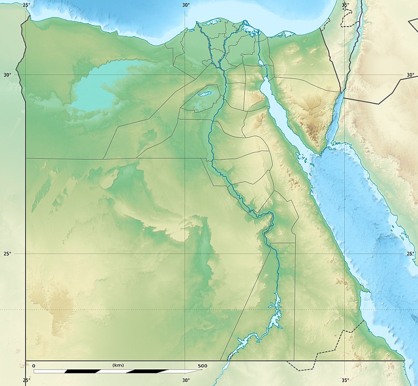
Deutsch: Relief Positionskarte von Ägypten
English: Physical location map of Egypt.
Français : Carte physique vierge destinée à la géolocalisation de l'Égypte telle que depuis le 14 avril 2011 suite à la dissolution des gouvernorats du 6 Octobre et de Helwan. Topographic scale: 1:4,932,000 (precision: 1,233 m)
Geographic limits of the map:
|
||
| Sáne | 2010-03, updated 2014-06 | ||
| Fayl deregi |
Topographic background map: Own work
|
||
| Avtor | Eric Gaba (Sting - fr:Sting) and NordNordWest | ||
| Ruqsat (Bul fayldan qayta paydalanıw) |
|
||
| Басқа нұсқалары |
Derivative works of this file: Lower Egypt ancient nomes position map.jpg
|


| Camera location | | View this and other nearby images on: OpenStreetMap |
|---|

|
This map has been made or improved in the German Kartenwerkstatt (Map Lab). You can propose maps to improve as well.
|
Licenziyalaw
Мен бұл туындының авторымын, келесі лицензия аясында бұны жариялаймын:

|
Bul hújjetten nusqa kóshiriw, tarqatıw yamasa ózgertiw ushın GNU Free Documentation License, versiya shártlerine muwapıq ruqsat berilgen. 1.2 yamasa Free Software Foundation tárepinen baspadan shıǵarılǵan hárqanday keyingi versiya ózgermeytuǵın bólimlersiz, aldınǵı muqaba tekstleri hám arqa muqaba tekstlerisiz boladı. Licenziya nusqası GNU Free Documentation License bólimine kirgizilgen. |
Bul fayl Creative Commons tiykarında licenziyalanǵan org/licenses/by-sa/3.0/deed.en Attribution-Share Alike 3.0 Unported licenziyası.
- Siz bossız:
- Bólisiw – Jumıstı nusqalaw, tarqatıw hám uzatıw
- Remiks qılıw – Jumısqa beyimlesiw
- Tómendegi shártler tiykarında :
- atribut – Siz tiyisli kredit beriwińiz, licenziyaǵa siltemeni usınıwıńız hám ózgertiwler kiritilgenligin kórsetiwińiz kerek. Siz bunı hár qanday aqılǵa say jol menen etiwińiz múmkin, biraq licenziar sizdi yamasa siziń paydalanıwıńızdı maqullawın usınıs etetuǵın tárizde emes.
- birdey shártlerde taratıw – Eger siz materialdı remiks qılsańız, ózgertseńiz yamasa oǵan tiykarlansańiz, óz úleslerińizdi túp nusqadaǵı sıyaqlı birdey yamasa uyqas licenziya tiykarında tarqatıwıńız kerek.
Siz ózińiz qálegen licenziyanı tańlawıńız múmkin.
Fayl tariyxı
Aldın usı fayl qanday kóriniste bolǵanın kóriw ushin kún-ay/waqıt degendi basıń.
| Sáne/Waqıt | Miniatyurası | Ólshemleri | Paydalanıwshı | Pikir | |
|---|---|---|---|---|---|
| házirgi | 14:01, 2017 j. avgusttıń 18 | | 1055 × 973 (459 КБ) | Mélomène | According with [https://en.wikipedia.org/wiki/Hala%27ib_Triangle] |
| 19:53, 2014 j. iyunnıń 13 |  | 1055 × 973 (450 КБ) | Sting | Color profile | |
| 19:43, 2014 j. iyunnıń 13 |  | 1055 × 973 (422 КБ) | Sting | Updated Governorates borders shape | |
| 13:59, 2011 j. apreldiń 18 |  | 1055 × 975 (415 КБ) | Sting | Updated after Governorats dissolution | |
| 13:30, 2010 j. iyuldıń 19 |  | 1055 × 973 (451 КБ) | Sting | Color profile | |
| 19:04, 2010 j. marttıń 7 |  | 1055 × 973 (450 КБ) | Sting | == {{int:filedesc}} == {{Location|26|42|00|N|30|45|00|E|scale:10000000}} <br/> {{Information |Description= {{de|Relief Positionskarte von Ägypten}} {{en|Physical location map of Egypt.}} {{fr|Carte physique vierge de l'[[:f |
Fayldıń paydalanılıwı
Tómendegi dana bette bul fayl paydalanılǵan:
Fayldı global paydalanıw
Tómendegi basqa wikilar bul fayldan paydalanadı:
- als.wikipedia.org joybarında qollanıw
- ar.wikipedia.org joybarında qollanıw
- arz.wikipedia.org joybarında qollanıw
- ast.wikipedia.org joybarında qollanıw
- Mar Roxu
- Canal de Suez
- Colosos de Coptos
- Faru d'Alexandría
- Muséu Exipcianu d'El Cairu
- Pirámides d'Exiptu
- Presa d'Asuán
- El Cairu
- Columna de Pompeyo
- Templu de Ramsés II (Abu Simbel)
- Módulu:Mapa de llocalización/datos/Exiptu
- Menfis
- Valle de los Reis
- Ilesia ortodoxa d'Alexandría
- Canal de los Faraones
- Biblioteca d'Alexandría
- Universidá d'al-Azhar
- Universidá d'El Cairu
- Alexandría
- Golfu d'Áqaba
- Gran Pirámide de Guiza
- Catacumbes de Kom el Shogafa
- Ciudadela d'El Cairu
- Península del Sinaí
- Abu Simbel
- Bibliotheca Alexandrina
- Templu d'Edfu
- Módulu:Mapa de llocalización/datos/Exiptu/usu
- Estadiu Internacional d'El Cairu
- KV63
- Damieta
- Cueva de les Besties
- Elefantina
- Gran Muséu Exipciu
Bul fayldıń kóbirek global paydalanıw bólimin kóriń.