
Fayl:Estonia location map (2005-2017) no rivers.svg

Size of this PNG preview of this SVG file: 718 × 600 пиксел. Basqa rezolyutsiyalar: 287 × 240 пиксел | 575 × 480 пиксел | 920 × 768 пиксел | 1226 × 1024 пиксел | 2452 × 2048 пиксел | 1668 × 1393 пиксел.
Túp fayl (SVG fayl, 1668 × 1393 piksel belgilengen, fayldıń ólshemi: 407 КБ)
Juwmaq
| Sıpatlama |
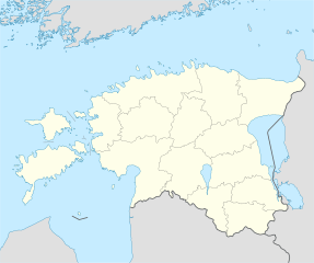
Deutsch: Positionskarte von Estland
Quadratische Plattkarte, N-S-Streckung 180 %. Geographische Begrenzung der Karte:
English: Location map of Estonia
Equirectangular projection, N/S stretching 180 %. Geographic limits of the map:
|
||
| Sáne | |||
| Fayl deregi | own work, using United States National Imagery and Mapping Agency data | ||
| Avtor | NordNordWest | ||
| Басқа нұсқалары |
Derivative works of this file: |
||
| SVG genesis |
|

_no_rivers.svg)
.svg)
Licenziyalaw
Мен бұл туындының авторымын, келесі лицензия аясында бұны жариялаймын:

|
Bul hújjetten nusqa kóshiriw, tarqatıw yamasa ózgertiw ushın GNU Free Documentation License, versiya shártlerine muwapıq ruqsat berilgen. 1.2 yamasa Free Software Foundation tárepinen baspadan shıǵarılǵan hárqanday keyingi versiya ózgermeytuǵın bólimlersiz, aldınǵı muqaba tekstleri hám arqa muqaba tekstlerisiz boladı. Licenziya nusqası GNU Free Documentation License bólimine kirgizilgen. |
Bul fayl Creative Commons tiykarında licenziyalanǵan org/licenses/by-sa/3.0/deed.en Attribution-Share Alike 3.0 Unported licenziyası.
- Siz bossız:
- Bólisiw – Jumıstı nusqalaw, tarqatıw hám uzatıw
- Remiks qılıw – Jumısqa beyimlesiw
- Tómendegi shártler tiykarında :
- atribut – Siz tiyisli kredit beriwińiz, licenziyaǵa siltemeni usınıwıńız hám ózgertiwler kiritilgenligin kórsetiwińiz kerek. Siz bunı hár qanday aqılǵa say jol menen etiwińiz múmkin, biraq licenziar sizdi yamasa siziń paydalanıwıńızdı maqullawın usınıs etetuǵın tárizde emes.
- birdey shártlerde taratıw – Eger siz materialdı remiks qılsańız, ózgertseńiz yamasa oǵan tiykarlansańiz, óz úleslerińizdi túp nusqadaǵı sıyaqlı birdey yamasa uyqas licenziya tiykarında tarqatıwıńız kerek.
Siz ózińiz qálegen licenziyanı tańlawıńız múmkin.
Fayl tariyxı
Aldın usı fayl qanday kóriniste bolǵanın kóriw ushin kún-ay/waqıt degendi basıń.
| Sáne/Waqıt | Miniatyurası | Ólshemleri | Paydalanıwshı | Pikir | |
|---|---|---|---|---|---|
| házirgi | 06:14, 2019 j. maydıń 6 | | 1668 × 1393 (407 КБ) | Lasunncty | fix svg errors and reduce file size |
| 20:05, 2009 j. maydıń 9 |  | 1668 × 1393 (464 КБ) | NordNordWest | some troubles with changing location maps that way | |
| 17:18, 2009 j. maydıń 9 |  | 1000 × 835 (639 КБ) | Ahnode | *1. Resized the objects to W:1000px, H:835px. *2. Created two separate layers for Estonia itself and the rest of the world. *3. Subtracted lakes from shape areas and divided area of Estonia into counties to ease future creation of location maps. | |
| 19:03, 2008 j. avgusttıń 25 |  | 1668 × 1393 (464 КБ) | NordNordWest | size correction | |
| 14:11, 2008 j. iyuldıń 7 |  | 556 × 464 (467 КБ) | NordNordWest | ||
| 14:25, 2008 j. iyunnıń 29 |  | 556 × 464 (468 КБ) | NordNordWest | {{Information |Description= {{de|Positionskarte von Estland}} Quadratische Plattkarte, N-S-Streckung 180 %. Geographische Begrenzung der Karte: * N: 60.4° N * S: 57.2° N * W: 21.5° O * O: 28.4° O {{en|Location map of [[:en:Estonia|Esto |
Fayldıń paydalanılıwı
Tómendegi dana bette bul fayl paydalanılǵan:
Fayldı global paydalanıw
Tómendegi basqa wikilar bul fayldan paydalanadı:
- af.wikipedia.org joybarında qollanıw
- ba.wikipedia.org joybarında qollanıw
- be-tarask.wikipedia.org joybarında qollanıw
- Талін
- Шаблён:Лякалізацыйная мапа Эстоніі
- Саарэмаа
- Талінскі ўнівэрсытэт
- Валга
- Выру
- Йыхві
- Вільяндзі
- Харку (возера)
- Выртс’ярв
- Пярну
- Муху
- Йыгева
- Раквэрэ
- Тартускі ўнівэрсытэт
- Тарту
- Шаблён:Пратока
- Шаблён:Пратока/Дакумэнтацыя
- Музэй акупацыяў
- Царква Сьвятога Міхаіла (Кейля)
- Царква прытулку Сьвятога Яна (Талін)
- Палдыскі
- Царква Сьвятога Яна (Талін)
- Калёна Перамогі ў вайне за незалежнасьць Эстоніі
- Нарва (горад)
- Кейля
- Курэсаарэ
- Саўэ
- Царква Сьвятога Олафа (Талін)
- Домскі сабор (Талін)
- Нараўскі замак
- Кохтла-Ярвэ
- Кейля (замак)
- Царква Сьвятога Марціна (Вальяла)
- Пылва
- Талінская ратуша
- Суўр Мунамягі
- Юлемістэ (возера)
- Кляштар Сьвятой Біргіты
- Пюхціцкі манастыр
- Элва
- Сабор Аляксандра Неўскага (Талін)
- Царква Сьвятога Духа (Талін)
- Хіюмаа
- Кік-ін-дэ-Кёк
- Стары Томас
- Эстонскі марскі музэй
Bul fayldıń kóbirek global paydalanıw bólimin kóriń.
_no_rivers.svg)
_no_rivers.svg)