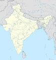
Fayl:India location map.svg

Size of this PNG preview of this SVG file: 557 × 600 пиксел. Basqa rezolyutsiyalar: 223 × 240 пиксел | 446 × 480 пиксел | 713 × 768 пиксел | 951 × 1024 пиксел | 1902 × 2048 пиксел | 1500 × 1615 пиксел.
Túp fayl (SVG fayl, 1500 × 1615 piksel belgilengen, fayldıń ólshemi: 1,23 MB)
Fayl tariyxı
Aldın usı fayl qanday kóriniste bolǵanın kóriw ushin kún-ay/waqıt degendi basıń.
| Sáne/Waqıt | Miniatyurası | Ólshemleri | Paydalanıwshı | Pikir | |
|---|---|---|---|---|---|
| házirgi | 09:24, 2021 j. apreldiń 4 |  | 1500 × 1615 (1,23 MB) | TKsdik8900 | Fulfilling the edit request (File talk:India location map.svg#Upload more compact version of India location map) by C1MM |
| 16:50, 2020 j. oktyabrdiń 14 |  | 1500 × 1615 (1,64 MB) | NordNordWest | correct Telangana/Andhra Pradesh | |
| 23:10, 2019 j. noyabrdiń 3 |  | 1500 × 1615 (1,62 MB) | RaviC | slight colour change for consistency | |
| 23:06, 2019 j. noyabrdiń 3 |  | 1500 × 1615 (1,62 MB) | RaviC | == {{int:filedesc}} == {{Information |Description={{en|Location map of India. Equirectangular projection. Strechted by 106.0%. Geographic limits of the map: * N: 37.5° N * S: 5.0° N * W: 67.0° E * E: 99.0° E Made with Natural Earth. Free vector and raster map data @ naturalearthdata.com.}} |Source={{own}} |Date=2010-02-20 |Author={{user at project|Uwe Dedering|wikipedia|de}} |Permission= |other_versions={{DerivativeVersions|India location map2.svg|India location map 3.png}} {{Other versions/I... | |
| 21:42, 2014 j. avgusttıń 19 |  | 1500 × 1615 (1,59 MB) | M0tty | Update by Sémhur : add the state of Telangana | |
| 11:51, 2011 j. iyunnıń 7 |  | 1500 × 1615 (1,49 MB) | NordNordWest | Nagaland corrected | |
| 16:10, 2011 j. yanvardıń 18 |  | 1500 × 1615 (2,36 MB) | Uwe Dedering | Reverted to version as of 15:50, 17 January 2011 and again, layer structure destroyed, and first discuss this! | |
| 19:04, 2011 j. yanvardıń 17 |  | 1500 × 1615 (1,52 MB) | AshwiniKalantri | The disputed land of Kashmir are shown in a different shade. | |
| 15:50, 2011 j. yanvardıń 17 |  | 1500 × 1615 (2,36 MB) | Uwe Dedering | Reverted to version as of 11:34, 22 September 2010 vandalism | |
| 23:30, 2011 j. yanvardıń 16 |  | 1500 × 1615 (2,01 MB) | AshwiniKalantri | {{Information |Description=Location Map of India |Source= |Date= |Author= |Permission= |other_versions= }} |
Fayldıń paydalanılıwı
Tómendegi dana bette bul fayl paydalanılǵan:
Fayldı global paydalanıw
Tómendegi basqa wikilar bul fayldan paydalanadı:
- ace.wikipedia.org joybarında qollanıw
- af.wikipedia.org joybarında qollanıw
- Leh
- Taj Mahal
- Amritsar
- Sjabloon:Liggingkaart Indië
- Indore
- Thane
- Bhopal
- Visakhapatnam
- Pimpri-Chinchwad
- Vadodara
- Ghaziabad
- Ludhiana
- Nashik
- Faridabad
- Meerut
- Rajkot
- Kalyan-Dombivali
- Vasai-Virar
- Srinagar
- Aurangabad
- Dhanbad
- Navi Mumbai
- Prayagraj
- Ranchi
- Haora
- Coimbatore
- Jabalpur
- Gwalior
- Vijayawada
- Jodhpur
- Madurai
- Raipur
- Kota
- Guwahati
- Chandigarh
- Solapur
- Hubli-Dharwad
- Indiese nasionale krieketspan
- Tiruchirappalli
- Thiruvananthapuram
- Krieketwêreldbeker 1987
- Krieketwêreldbeker 1996
- Krieketwêreldbeker 2011
- Krieketwêreldbeker 2023
- Jaynagar Majilpur
- Wes-Ghats
- Kushok Bakula Rimpochee Lughawe
Bul fayldıń kóbirek global paydalanıw bólimin kóriń.


