
Fayl:United Kingdom NUTS location map.svg

Size of this PNG preview of this SVG file: 388 × 600 пиксел. Basqa rezolyutsiyalar: 155 × 240 пиксел | 310 × 480 пиксел | 497 × 768 пиксел | 663 × 1024 пиксел | 1325 × 2048 пиксел | 886 × 1369 пиксел.
Túp fayl (SVG fayl, 886 × 1369 piksel belgilengen, fayldıń ólshemi: 873 КБ)
| Sıpatlama |
Deutsch: Positionskarte des Vereinigten Königreichs mit NUTS-1-Gebieten
Quadratische Plattkarte, N-S-Streckung 170 %. Geographische Begrenzung der Karte:
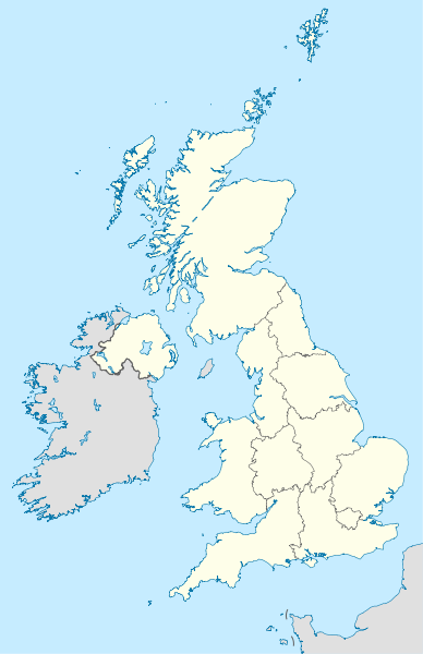
English: Location map of the United Kingdom with NUTS 1 areas
Equirectangular projection, N/S stretching 170 %. Geographic limits of the map:
|
| Sáne | (UTC) |
| Fayl deregi | |
| Avtor |
|
| Басқа нұсқалары |
|


Bul fayl Creative Commons tiykarında licenziyalanǵan org/licenses/by-sa/3.0/deed.en Attribution-Share Alike 3.0 Unported licenziyası.
- Siz bossız:
- Bólisiw – Jumıstı nusqalaw, tarqatıw hám uzatıw
- Remiks qılıw – Jumısqa beyimlesiw
- Tómendegi shártler tiykarında :
- atribut – Siz tiyisli kredit beriwińiz, licenziyaǵa siltemeni usınıwıńız hám ózgertiwler kiritilgenligin kórsetiwińiz kerek. Siz bunı hár qanday aqılǵa say jol menen etiwińiz múmkin, biraq licenziar sizdi yamasa siziń paydalanıwıńızdı maqullawın usınıs etetuǵın tárizde emes.
- birdey shártlerde taratıw – Eger siz materialdı remiks qılsańız, ózgertseńiz yamasa oǵan tiykarlansańiz, óz úleslerińizdi túp nusqadaǵı sıyaqlı birdey yamasa uyqas licenziya tiykarında tarqatıwıńız kerek.
Тұпнұсқа жүктеу журналы
This image is a derivative work of the following images:
- File:United_Kingdom_location_map.svg licensed with Cc-by-sa-3.0, GFDL
- 2011-01-11T22:14:29Z NordNordWest 886x1369 (660787 Bytes) upd
- 2008-07-19T21:44:02Z NordNordWest 886x1369 (1484834 Bytes) '
- 2008-07-07T14:29:12Z NordNordWest 886x1369 (1484834 Bytes) '
- 2008-07-01T16:17:52Z NordNordWest 886x1369 (1547699 Bytes) '
- 2008-07-01T16:05:12Z NordNordWest 886x1369 (1546376 Bytes) {{Information |Description= {{de|Positionskarte des [[:de:Vereinigtes Königreich|Vereinigten Königreichs]]}} Quadratische Plattkarte, N-S-Streckung 170 %. Geographische Begrenzung der Karte: * N: 61.0° N * S: 49.0° N * W:
- File:England_location_map.svg licensed with Cc-by-sa-3.0
- 2010-03-12T22:58:19Z Spischot 816x991 (468569 Bytes) {{Information |Description= {{de|Positionskarte von [[:de:England|]]}} Quadratische Plattkarte, N-S-Streckung 170 %. Geographische Begrenzung der Karte: * N: 56.0° N * S: 49.75° N * W: 6.75° W * O: 2.0° O {{en|Location
Uploaded with derivativeFX
Fayl tariyxı
Aldın usı fayl qanday kóriniste bolǵanın kóriw ushin kún-ay/waqıt degendi basıń.
| Sáne/Waqıt | Miniatyurası | Ólshemleri | Paydalanıwshı | Pikir | |
|---|---|---|---|---|---|
| házirgi | 14:12, 2011 j. yanvardıń 22 | | 886 × 1369 (873 КБ) | NordNordWest | {{Information |Description={{de|Positionskarte des Vereinigten Königreichs mit NUTS-1-Gebieten}} Quadratische Plattkarte, N-S-Streckung 170 %. Geographische Begrenzung der Karte: * N: 61.0° N * S: 49.0° N * W: 11.0° |
Fayldıń paydalanılıwı
Tómendegi dana bette bul fayl paydalanılǵan:
Fayldı global paydalanıw
Tómendegi basqa wikilar bul fayldan paydalanadı:
- als.wikipedia.org joybarında qollanıw
- ast.wikipedia.org joybarında qollanıw
- ce.wikipedia.org joybarında qollanıw
- ckb.wikipedia.org joybarında qollanıw
- de.wikipedia.org joybarında qollanıw
- diq.wikipedia.org joybarında qollanıw
- en.wikipedia.org joybarında qollanıw
- es.wikipedia.org joybarında qollanıw
- frr.wikipedia.org joybarında qollanıw
- hy.wikipedia.org joybarında qollanıw
- io.wikipedia.org joybarında qollanıw
- ka.wikipedia.org joybarında qollanıw
- kbd.wikipedia.org joybarında qollanıw
- ky.wikipedia.org joybarında qollanıw
- lez.wikipedia.org joybarında qollanıw
- mn.wikipedia.org joybarında qollanıw
- myv.wikipedia.org joybarında qollanıw
- nap.wikipedia.org joybarında qollanıw
- ne.wikipedia.org joybarında qollanıw
Bul fayldıń kóbirek global paydalanıw bólimin kóriń.